Many people are surprised to discover that remnants of the Oregon Trail still exist, stretching from its starting point in Missouri all the way to its end in Oregon. Standing in the very spots where pioneers once stood and following their tracks offers a profound connection to history, one that reading alone can never fully capture.
So I’d recommend trying to make an Oregon Trail road trip at least once in your life.
During our months visiting in Idaho, we explored many of the Oregon Trail sites scattered throughout the state, and that’s what this article will focus on.
Table of Contents
Overview of Idaho’s Oregon Trail Landmarks
The Oregon Trail was a monumental route in American history, stretching over 2,000 miles from Missouri to the fertile valleys of Oregon. Between the 1840s and 1860s, more than 400,000 pioneers embarked on this arduous journey, driven by the promise of rich farmland, economic opportunity, and a fresh start in the West.
Idaho certainly played a role in this migration, with its rugged landscapes presenting both challenges and critical decision points for travelers, such as at Three Island Crossing.
Lots of emigrants would have traversed Idaho in the peak of the summer, sometimes dealing with temperatures over 100º F and long stretches of barren, yet rocky terrain as they followed the winding Snake River.
Much of Idaho’s Interstate 84 indeed follows the path of the historic Oregon Trail, closely tracing the main route that pioneers once traveled. However, there were several cutoffs and alternate routes that branched off from the main trail. This allowed settlers to “choose their own adventure” depending on their destination, the season, and the conditions they encountered. Just like the classic video game.
Below are several key spots along the main Oregon Trail in Idaho worth exploring. Most of these can be quickly explored though I think it’s worth spending a bit more time at some of the state parks because they are beautiful places and some of them have interesting exhibits to see.
Soda Springs
For the pioneers, Soda Springs was known for being an “Oregon Trail Oasis.”
They not only found refreshing cold springs here but the springs here are also carbonated. That’s right, they produce naturally fizzy water. And what’s even better — you can drink this sparkling water directly out of the spring. So bring a glass!
For someone like me who is obsessed with sparkling water this is one of the most amazing things I’ve ever seen.
The springs you want to head for to get some bubbly are Hooper Springs and Octagon Springs. (If you want a little more bubbly, Octagon Springs is your best bet.) As for the taste, prepare your taste buds for something similar to licking a penny. I recommend bringing some flavor packets with you to help with the taste.

And while you’re at it, you might as well check out Soda Springs’ claim to fame—the world’s only captive geyser, known as the Soda Springs Geyser. This unique geyser is controlled by a valve and erupts on demand every hour, shooting water high into the air. Originally tapped in the early 20th century by accident during a well-drilling operation, it quickly became a fascinating attraction.

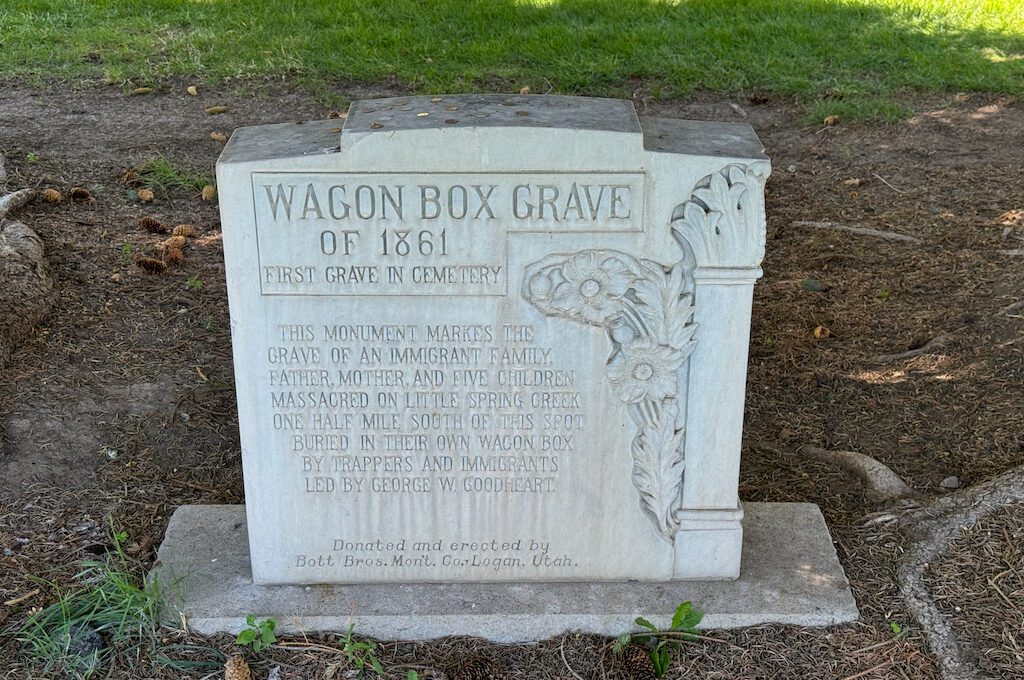
While in town, you should also take the time to visit the Wagon Box Grave. This site marks the resting place of a pioneer family who tragically lost their lives during a skirmish with Native Americans. They were all buried in the very own wagon box.
Oregon Trail Park and Marina
Just near Soda Springs is the Oregon Trail Park and Marina. Unless you’re going for a boat ride, you’ll probably just quickly stop by this historic spot but it will be worth it.
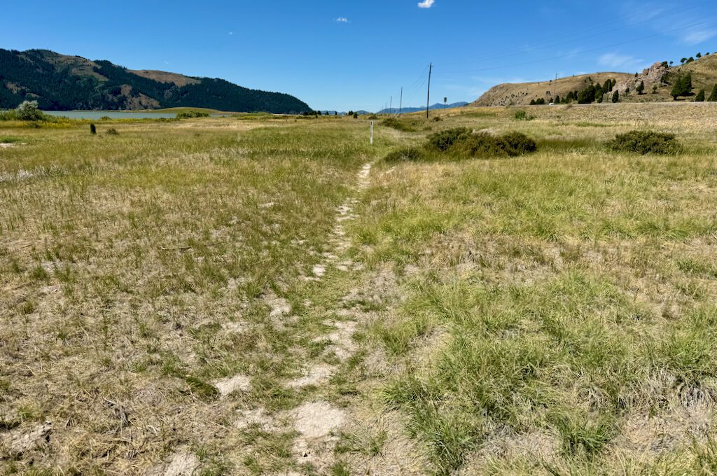
As soon as you pull in you’ll see a little pull out on the right and that’s going to give you the view of the wagon ruts. It’s a pretty short segment but it’s still always amazing to see traces of the exact Oregon Trail. (You can see the traces on both sides of this entrance road.)
Fort Hall replica
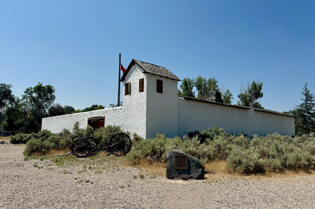
If you make your way through the town of Pocatello, Idaho, you’ll come across a replica of Fort Hall, a significant trading post established in 1834 by Nathaniel Jarvis Wyeth. Originally built as a fur trading post, Fort Hall became an important stop for pioneers traveling along the Oregon Trail, providing supplies and respite.
The replica, located at the Fort Hall Replica Park, offers visitors a glimpse into the fort’s original construction with its wooden palisades, blockhouses, and trading rooms. Inside, the exhibits showcase artifacts from the 19th century, including tools, clothing, and trade goods used by the fort’s inhabitants and visitors.
There’s also a scaled-down little town adjacent to the Fort Hall replica that features a variety of historic buildings meant to replicate the early days of Pocatello. Visitors can explore a schoolhouse, where desks and chalkboards recreate the atmosphere of 19th-century education, and a courtroom, complete with a judge’s bench and seating for spectators.
Other buildings in the town include a blacksmith shop, a general store, and a grocery store, each furnished with period-appropriate tools, goods, and decor. It’s a unique immersive experience that allows you to step back in time and get a sense of daily life in a pioneer community. It’s worth the stroll.

Massacre Rocks Rest Area (Historical Site)
Massacre Rocks State Park, located along the Oregon Trail, is a beautiful and serene park. I enjoyed the stunning views of the Snake River from the canyon walls above and was pleased to see others appreciating nature, some even taking time to fish along the river’s edge. It’s a very peaceful place (despite the name).
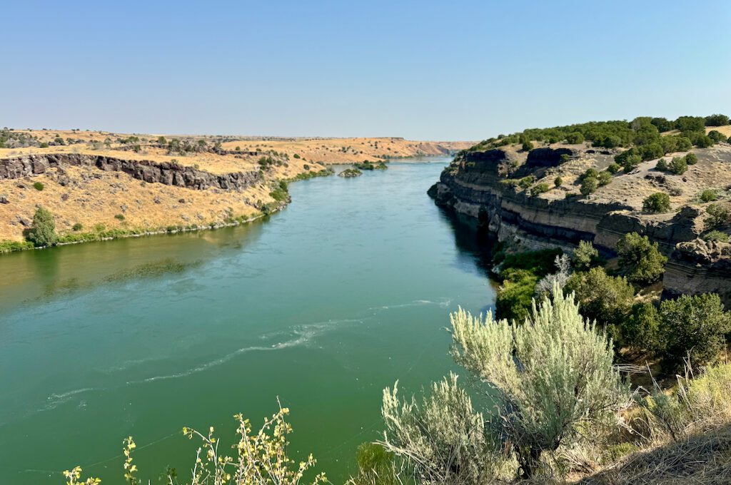
When we first ventured into Massacre Rocks State Park, I was eager to find the trail ruts from the Oregon Trail. We drove up and down the park, hopping off at different overlooks. However, after some exploring (and then snagging a map from the visitor’s center), I realized that the actual ruts weren’t within the park itself but were located between the interstate highway lanes.
You can access these ruts from a trail that runs from the end of the park, but there’s also a rest area when heading west on I-86 where you can stop. From there, you can take a short trail that leads through a couple of tunnels under the highway, guiding you directly to the historic ruts. A bit unconventional but historic nonetheless.
When you make your way to Massacre Rocks State Park, be sure to stop by Register Rock. (It’s only a few minutes away from the Massacre Rocks State Park entrance.)
As you approach it, you’ll see a large boulder where some of the pioneers once engraved their names and visit dates. It’s similar to Independence Rock in Wyoming, although I haven’t had the privilege to visit there yet. Register Rock is protected by a pavilion and a gate, so don’t touch the rock.
You can find some carvings on some of the other smaller rocks as well. To me it’s definitely one of my top highlights of the Oregon Trail in Idaho.

Tip: If you purchase a day pass to an Idaho State Park, it’s good for other state parks that same day.
Three Island Crossing State Park
Three Island Crossing State Park was my favorite spot out of all the places we visited in Idaho. I loved the charm of the town, Glenns Ferry, and found it fascinating to explore. The park boasts a nice welcome center with a small museum that’s definitely worth checking out (be sure to catch the short film).
This site is known for being the spot where pioneers had to make a critical decision: whether to stay on the south side of the Snake River, facing a hotter and rockier path, or to cross the river and take a more direct route to Boise. The crossing was risky, but it offered a shorter and potentially easier journey through the treacherous terrain.
What’s cool about Three Island Crossing is that you can see ruts from both sides of the Oregon Trail. If you drive up to the Three Island Crossing Overlook on the south side of the river, you can view the alternate path taken by those who chose not to cross the river.
From up there, you have an amazing view of the small river islands that the settlers would “hop” across while making their way through the river. You can easily imagine pioneers watching as others struggled below, navigating wagons and oxen through the potentially dangerous river waters. It must have been quite a spectacle to witness.

Behind the Three Island Crossing Overlook, on the sides of the road, you just have to look for the white posts and they will show you where the swales are and you can do a little bit of exploring up there.

If you’re back down by the Snake River in the park, make it all the way down S Star Ln and then you will see a little trail gate entrance. This will take you to the ruts where the settlers made their way out of the river after crossing.
It can be a bit confusing because there’s a large “Do Not Enter” sign at the end of the road, but the entrance to the site is just adjacent to it. The landscape isn’t always maintained, so you might encounter some overgrown bushes blocking the entrance—just be prepared for that.
Once you get through, you can walk along the riverbanks and see the spots where pioneers would have emerged from the river and continued their journey. You can easily imagine the relief they must have felt after making it through such a potentially treacherous crossing. I’m sure plenty of celebrating went down at this spot! Perhaps a shot or two of whisky was taken.
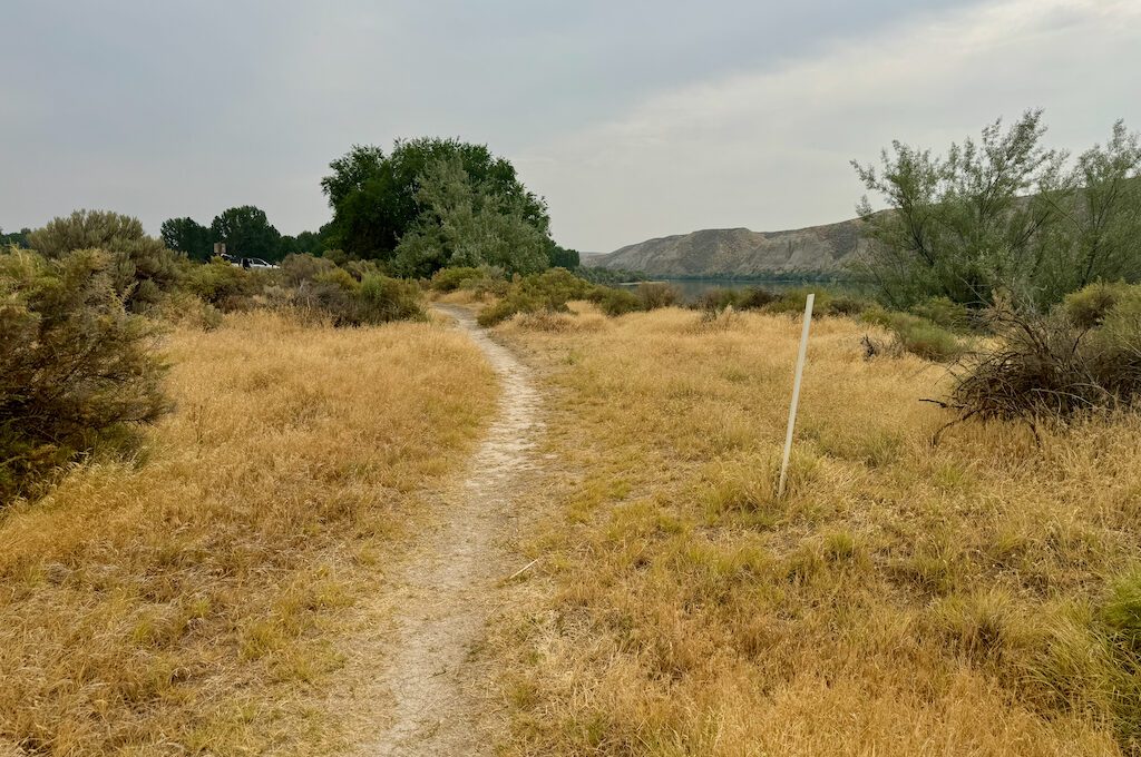
It’s a beautiful view right by the water and I enjoyed it except for getting swarmed by all sorts of bugs! Pants might be a good idea.
Bonneville Point
Bonneville Point is where pioneers first caught sight of the Boise River Valley after months of traversing the harsh high desert of southern Idaho.
This was a major milestone for them, as the lush, green landscape of the valley offered a stark contrast to the barren terrain they had endured. The view likely brought a sense of relief and renewed hope, giving them a taste of the fertile lands they anticipated in Oregon.
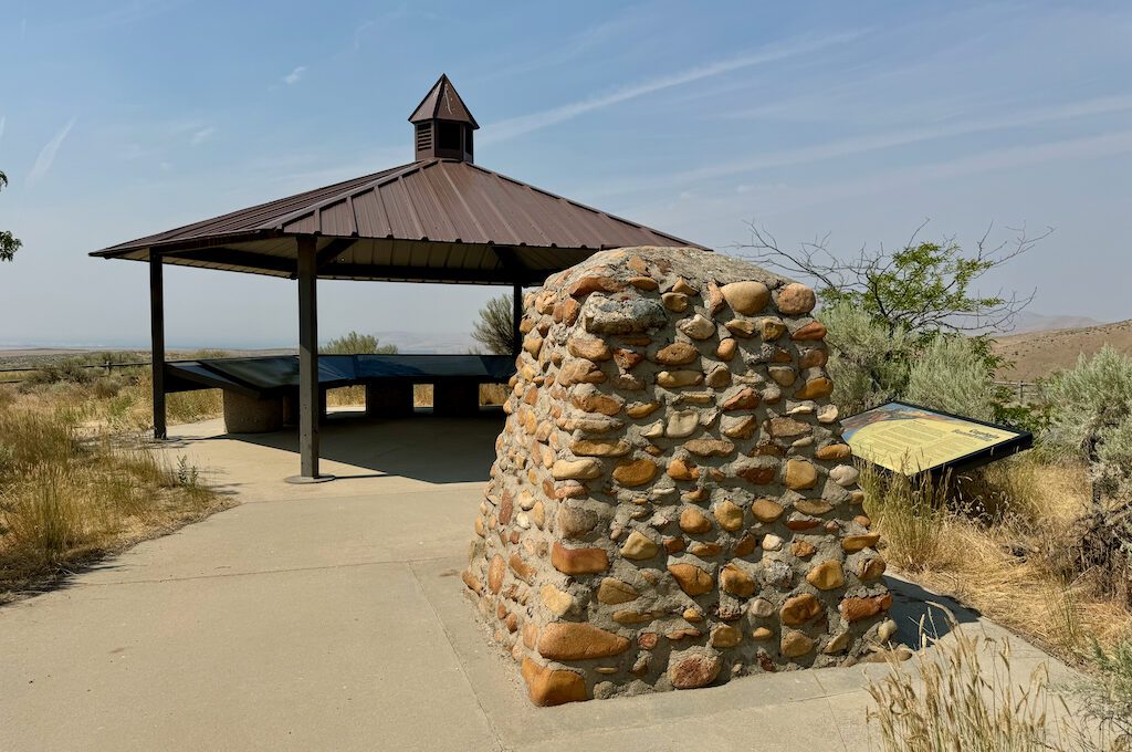
Like some of the other places, it’s a little confusing as to where exactly the Oregon Trail ruts are. That’s because you can see several different paths going through here on the way to Boise. I admired them from the vantage point of my drone but it was enough for me to know that this was a major point along the Oregon Trail.

There are still quite a few other Oregon Trail places in Idaho that I was not able to visit but I am aware of. For example, Big Hill (Montpelier, Idaho), which was a steep hill that the pioneers had to contend with is located in southeast Idaho. I’ll get there soon enough. Fort Boise is another. There are also places in Craters of the Moon National Monument and the City of Rocks that I haven’t been able to get to just yet. Soon enough.
If you want to discover more locations throughout other states, find more here and here.
Daniel Gillaspia is the Founder of UponArriving.com and the credit card app, WalletFlo. He is a former attorney turned travel expert covering destinations along with TSA, airline, and hotel policies. Since 2014, his content has been featured in publications such as National Geographic, Smithsonian Magazine, and CNBC. Read my bio.

