The Cape Cod region boasts stunning coastlines, complete with beautiful waters and pristine white sand beaches. Now, don’t get me twisted – it’s a picturesque part of the country.
But as a lover of the West Coast who revels in the allure of elevated landscapes, I can’t help but feel a tad underwhelmed by the flat terrain here.
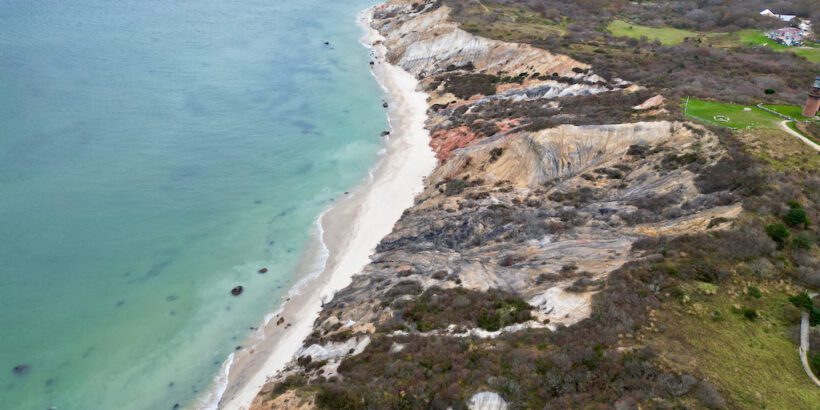
That said, there’s the Aquinnah Cliffs on Martha’s Vineyard, which deliver breathtaking vistas reminiscent of the West Coast’s most captivating beaches, making them a must-see in the East.
What are the Aquinnah Cliffs?
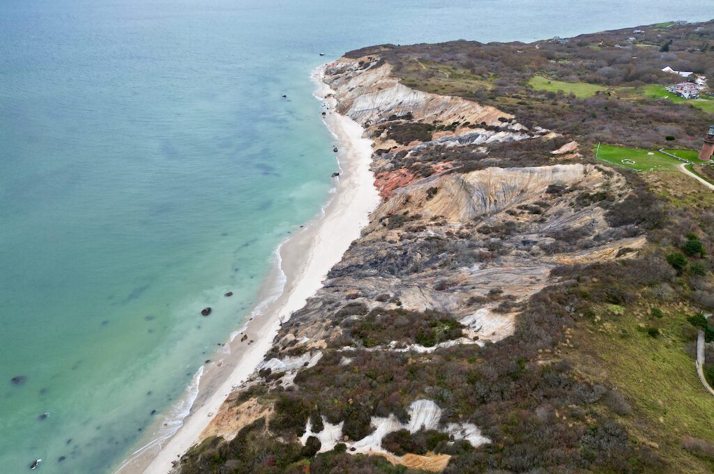
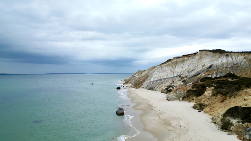
The Aquinnah Cliffs (formerly Gay Head) are stunning 150-foot clay cliffs found on the western end of Martha’s Vineyard. They are a major tourist attraction as is the Gay Head Lighthouse located next door.
These stunning cliffs of sand were formed during the last glacial period. Perhaps around 12,000 to 19,000 years ago, the Laurentide ice sheet receded back towards the north depositing a mixture of clay, sand, and gravel which formed Martha’s Vineyard and Nantucket.
The Aquinnah Cliffs were likely formed when these glaciers thrust various sedimentary layers upward into a landmass. As the glaciers retreated, the melting ice and water further sculpted the landscape, exposing the distinct layers of colorful clay and creating the dramatic, fossil-rich cliffs seen today.
For 10,000 years, this slice of the world has been home to Native Americans, namely descendants of the Wampanoag tribe, who fished, grew crops, and hunted whales here.
In 1669 English colonists arrived on the island and in 1870, they officially carved out the town of Aquinnah and gave it the rather vivid name of “Gay Head,” inspired by the eye-popping hues of the cliffs.
However, in 1997, the town pivoted with a 79 to 21 popular vote, swapping out Gay Head for Aquinnah, which translates to “land under the hill” in Wampanoag.
Two things to keep in mind when visiting
Keep in mind that the Aquinnah Cliffs are located on tribal lands.
They are home to the Wampanoag, whose ancestors have lived on the island for thousands of years. The cliffs are sacred to the tribe and have played a major role in their traditions and culture.
Also, the cliffs are protected and prone to corrosion. You are not allowed to climb on the cliffs or remove any of the clay.
In the past, people would take clay baths on the beach but this is definitely not permitted these days. Violating these laws can lead to fines or even arrest.
Related: Martha’s Vineyard Gingerbread Houses Guide: Visiting and Booking
Our experience at Aquinnah Cliffs
Our journey to Aquinnah Cliffs unfolded on a quiet November weekday, sparing us the overwhelming summer crowds. No parking pandemonium, no need to resort to bikes or buses to get there. Of course, the trade-off was the November chill, accentuated by the steady sea breezes. But let me tell you, the stunning scenery made every shiver worthwhile.
Upon arriving, the parking lot was a spacious haven, a stark contrast to the chaotic summer scene. Ascending a flight of steps, we stumbled upon a little commercial village of sorts, complete with many shops, including Bowen’s Arrow gift shop and others.
For those looking to grab a bite, there’s the nearby Outermost Inn and a couple of other eateries here.
When we swung by during the off-season, the gift shops were on a hiatus (the restaurant might have still been open) but it was otherwise a ghost town vibe.
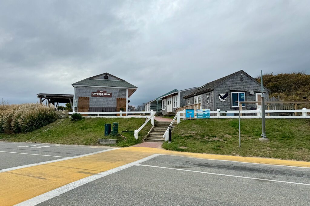
Word on the street is that there are plans to set up a 10,0000-square-foot casino in the area. But, it sounds like it’s been a bumpy ride with quite a bit of opposition and legal challenges. I’m not sure about the exact location.
Personally, I hope it’s not right on the cliff area and I think it might be planned for somewhere more on the interior of the island but either way, the Martha Vineyard Commission has sued to halt its developments and appears to still be pending.
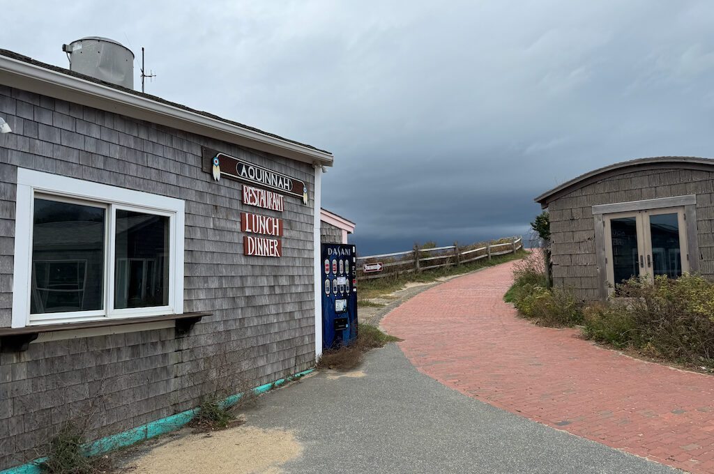
Anyway, to get to this little village area from the main parking lot, it’s a pretty short walk uphill to the overlook. You will see a sign that says “to the cliffs” and you just need to follow the brick path.
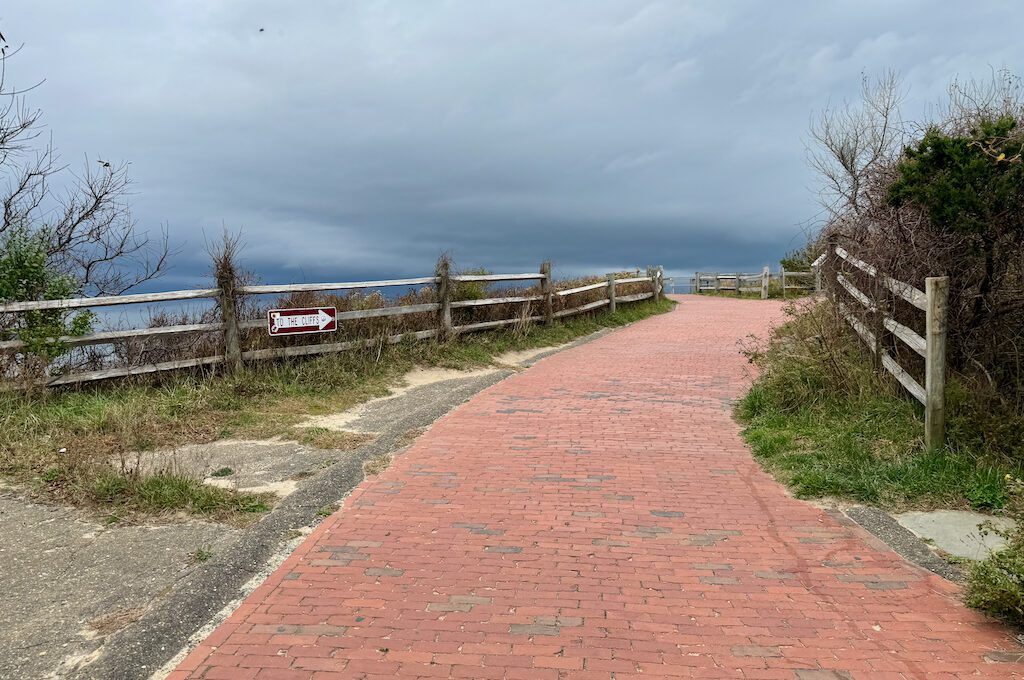
The overlook platform is pretty spacious and has multiple levels to it. While I am sure it gets quite crowded in the summer it’s nice that there is a good amount of real estate to work with.
Before I checked out the spot in person, I’d seen a few pics of the overlook, but I hadn’t really pored over them. So when we rolled up, the view was pretty fresh to me.
I couldn’t help but be overly impressed.
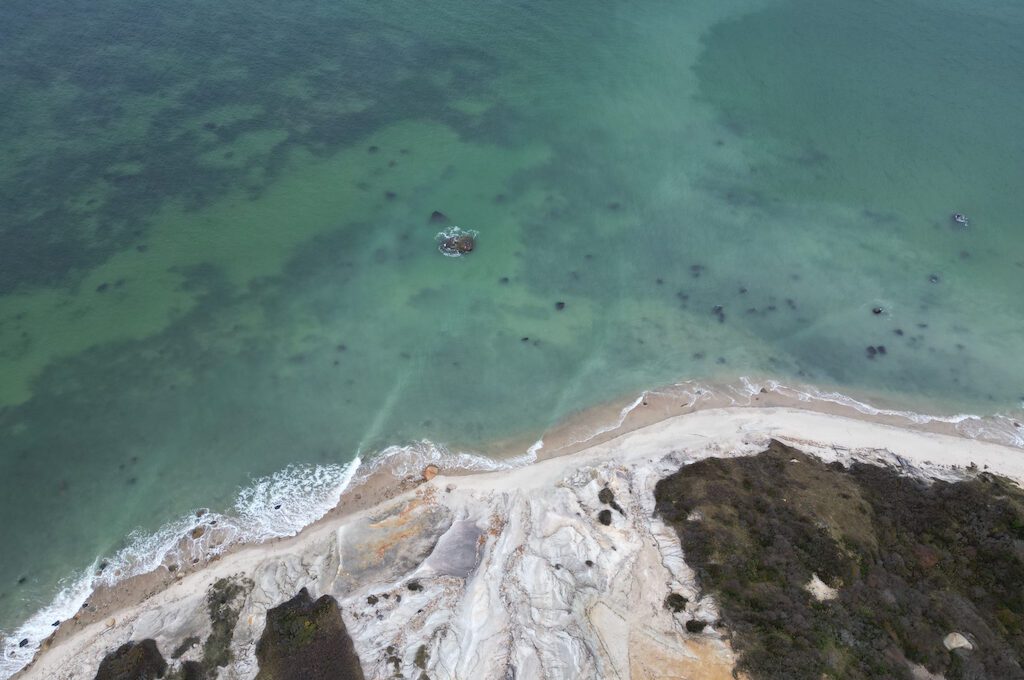
There was a storm brewing off the coast, and it painted this cool gray backdrop against the clay cliffs and the aqua waters below, about 150 feet down. With the waves crashing below, it was a stunning experience.
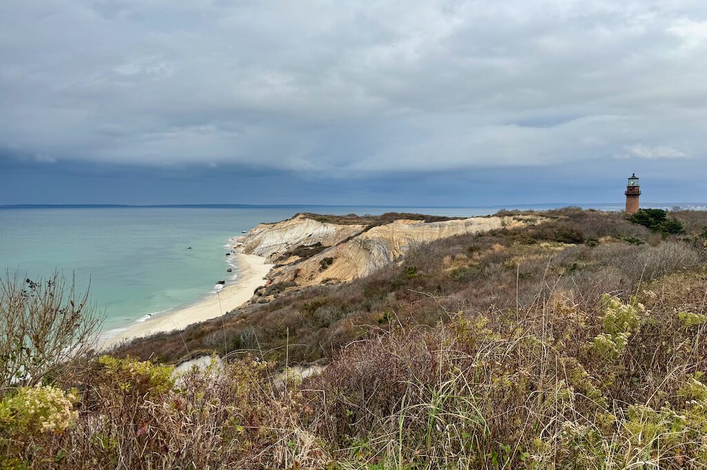
Gazing into the distance, on a clear day, the Elizabeth Islands unfold to the Northwest. Among them, Cuttyhunk stands out, said to be the site of arguably the first short-lived colony in New England.
To the south, Normans Land Island comes into view. It was the original “Martha’s Vineyard” and was once used by the US Navy as a practice bombing range from 1943 to 1996 (and is still home to unexploded weapons).
To the north, you can see stretches of the mainland from Massachusetts to Rhode Island.
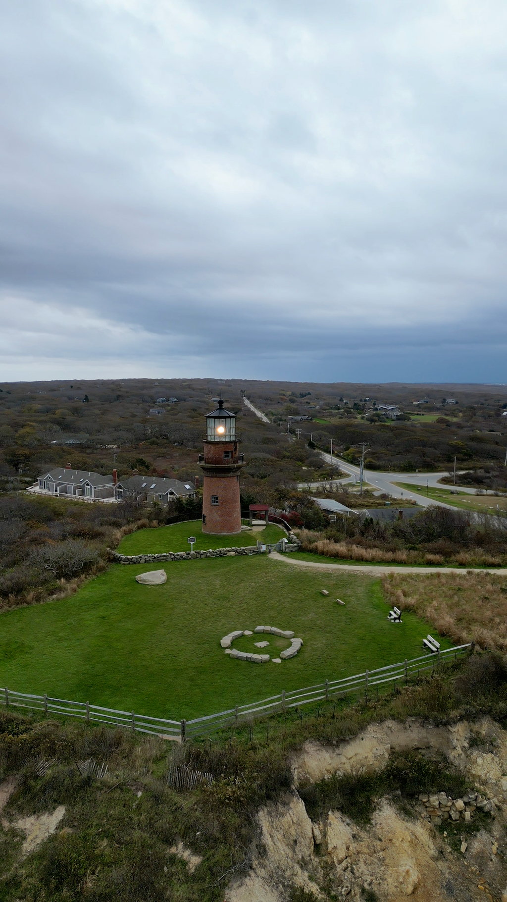
Just next door commands attention, the renowned Gay Head Lighthouse. This historic beacon, once featured in the movie Jaws, holds the distinction of being the inaugural lighthouse erected on Martha’s Vineyard.
In the late 1700s, Congress allocated $570 to Secretary of the Treasury Alexander Hamilton for its construction.
The driving force?
The burgeoning whaling industry, necessitating a guiding light for safe navigation through the treacherous waters of Vineyard Sound. On November 7, 1799, the inaugural flick of the switch set the light ablaze.
Navigating through the years, the lighthouse underwent multiple rebuilds and upgrades with its current form being built in 1856.
In the 1980s, it faced near destruction, but a collective effort saved the day. Reopened to the public in 1986 after a hiatus that had been going on since 1956, the lighthouse still stands as a testament to preservation.
Much like its Nantucket counterpart, Sankaty Head Lighthouse, this lighthouse has changed its address before.
In 1844, the original octagonal wooden light tower gracefully stepped back 75 feet from the eroding clay cliffs. Then, on May 30th, 2015, the presently standing tower executed another move, this time an impressive 134 feet from its original location. (The original location is still marked by a circular marker.)
Now it should be safe from peril for well over a century, though we will see what the future holds.
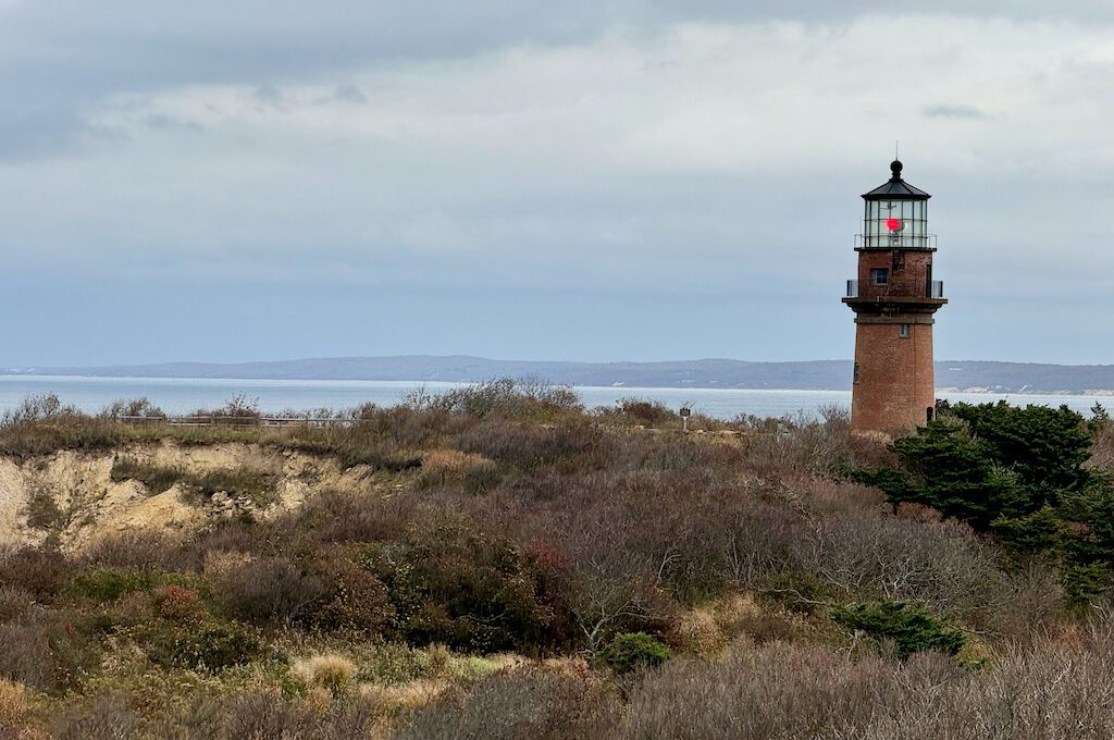
The lighthouse is still operational and you’ll be able to get some great photos of it from the overlook but you can also get a closer look but walking up to it or even doing a tour. Unfortunately, it was not open for us when we visited.
In addition to the Gay Head Lighthouse there’s also a small museum to check out known as the Aquinnah Cultural Center.
If you want to get down on the beach there is the Moshup Beach/Aquinnah Public Beach Parking Lot that you can use and then head down to Moshup Beach. I believe that certain parts of it in the past were known to be nude beaches so be prepared for that type of run-in.
Final word
Aquinnah Cliffs stands as one of Martha’s Vineyard’s prime attractions, and it’s easy to see why. For me, the towering cliffs were a welcome change after navigating the mostly flat terrain of Cape Cod. The mesmerizing aqua hue of the water, the pristine white beaches, and, of course, the vibrant clay cliffs all added to the allure. Even if the summer crowds come into play, I’d say it’s definitely worth a visit when you find yourself on Martha’s Vineyard.
Daniel Gillaspia is the Founder of UponArriving.com and the credit card app, WalletFlo. He is a former attorney turned travel expert covering destinations along with TSA, airline, and hotel policies. Since 2014, his content has been featured in publications such as National Geographic, Smithsonian Magazine, and CNBC. Read my bio.

